Search Term Record
Metadata
Name |
Plat Map |
Related Records
-
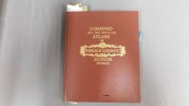
Book
Combined 1871, 1892, 1905 & 1929 Atlases of DeKalb County. Blue Sticky notes left on Kingston's map throughout the book.
Record Type: Object
-
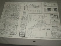
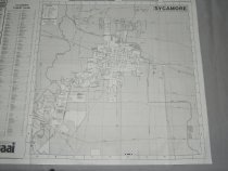
Map
Map, white background with blue letters and map sections, advertising DeKalb and Sycamore, Illinois businesses. Features city street maps of Sycamore and DeKalb and Northern Illinois University. Measures 35" x 23". Set of two
Record Type: Archive
-
Map
Map, white background with blue letters and map sections, advertising DeKalb and Sycamore, Illinois businesses. Features city street maps of Sycamore and DeKalb. Measures 35" x 23". Set of two
Record Type: Archive
-
Map
Map, white background with blue letters and map sections, advertising DeKalb and Sycamore, Illinois businesses. Features city street maps of Sycamore and DeKalb. Measures 38" x 23".
Record Type: Archive
-
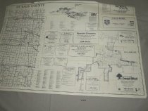
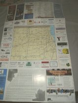
Map
Map, color with map sections, advertising DeKalb and Sycamore, Illinois businesses. Features city street maps of Sycamore and DeKalb. Measures 38" x 23".
Record Type: Archive
-
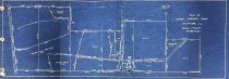
Plat
Plat Map; Plat of Engh Corners aka Engh Farm; undated; Shows Engh Farm property lines, permanent fences, and the use of individual plots.
Record Type: Archive